


38
The row over Israeli military map showing J&K as part of Pak, Northeast as Nepal
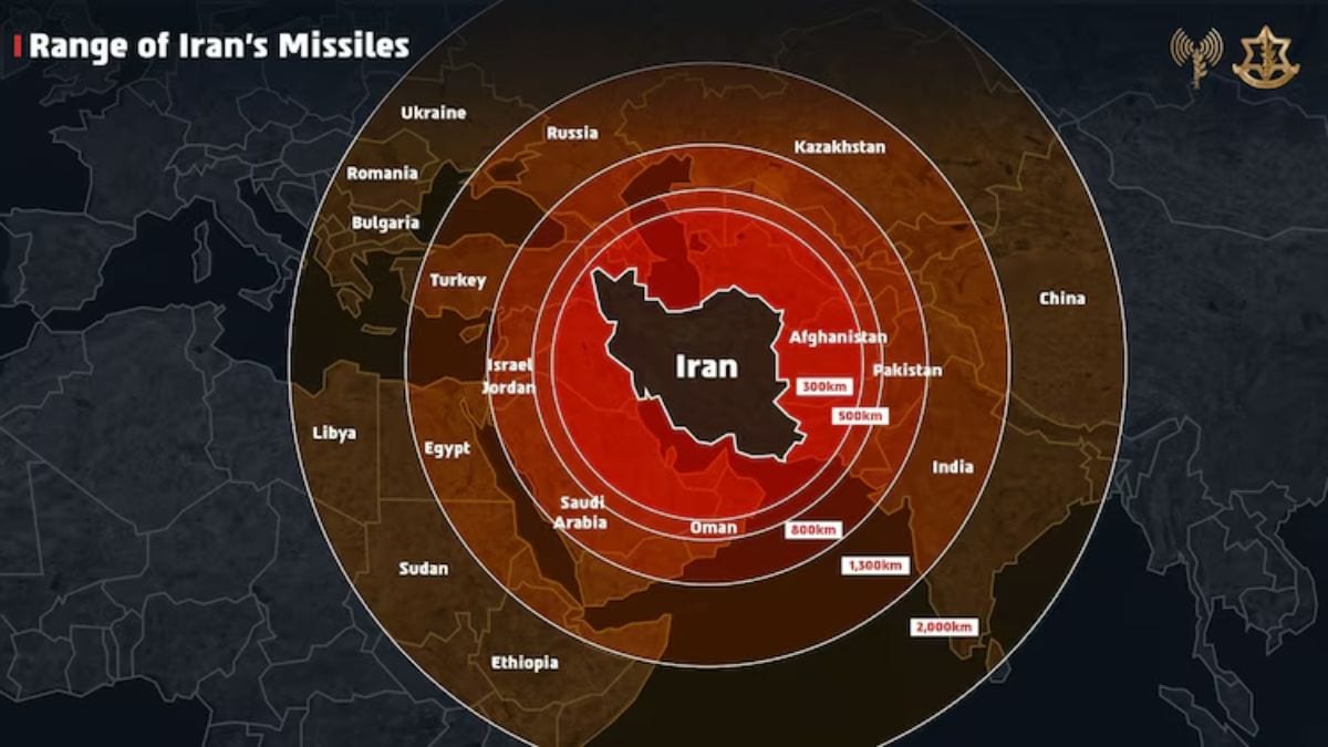
Amid tensions with Tehran, the Israel Defense Forces (IDF) shared a map that depicted the ‘global threat’ of Iranian missiles. However, the map incorrectly depicted India’s international boundaries and showed Jammu and Kashmir as part of Pakistan, and placed the states of the northeast within Nepal. While the IDF later apologised for the blunder, it left Indians fuming
On Friday, the Israel Defense Forces (IDF) shared a map on X that incorrectly depicted India’s international boundaries. It showed Jammu and Kashmir as part of Pakistan, and mistakenly placed the states of the northeast within Nepal. Image courtesy: X/@IDF
Was this article helpful?
Yes0No0
Discover more from Now World View
Subscribe to get the latest posts sent to your email.